This post is part of a featured blog series on cultural heritage and the legacies of colonialism in the fields of ancient Mediterranean, West Asian, and North African history and archaeology, which is the topic of the fourth season of the Peopling the Past podcast.
Following the events of 2011, referred to by Western voices as the Arab Spring, countries such as Syria, Libya, and Yemen were engulfed in war and conflicts which had serious consequences for heritage and archaeological sites. These have been bombed and looted, and archaeological materials are now known to have been sold on the black market. In contrast, other countries in the MENA region have managed to remain stable, which has ensured the protection of heritage sites and museums, but due to the low income and lack of management, heritage is facing challenges, such as rapid urban and agricultural expansion, in these areas as well. Because of the increased threats to cultural heritage, many research and documentation projects started to work on different affected regions using different tools and methodologies, among them the EAMENA Project.
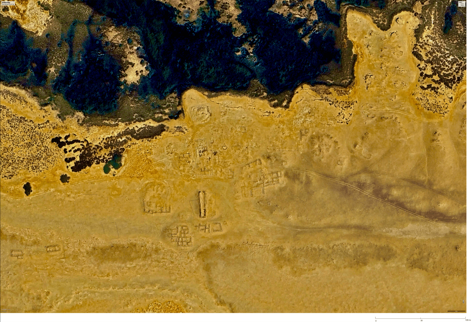
In 2015 the EAMENA Project was established to rapidly document endangered heritage and archaeology in the MENA region, funded by the charitable organization Arcadia. The Project is led by the University of Oxford, in collaboration with the Universities of Leicester and Durham. The project aims at recording, documenting, and monitoring heritage places using different tools and multidisciplinary methods, including remote sensing survey, modern and historic satellite imagery analysis, historical archaeological maps, aerial photography, machine learning and finally field visits.
Additional funds were also awarded to the project by the British Council’s Cultural Protection Fund to provide in country and remote training to heritage professionals in nine countries in the MENA region (Algeria, Tunisia, Libya, Egypt, Jordan, Palestine, Lebanon, Iraq, and Yemen). These training events have helped in building skills and transferring knowledge. An important goal of the project is to provide decision makers with data in order to better the management of heritage for future generations.

The considerable amount of data that was expected at the start of the project guided the team to use an open access database to store the collected data and make it available online. The ARCHES platform, created by the Getty Conservation Institute and the World Monuments Fund, was used to develop the customized EAMENA database (https://database.eamena.org). In 2023, we successfully moved to Arches v7. The team contributed to the internationalisation of Arches by translating English text to Arabic and French, to ensure its accessibility for users in the Middle East and North Africa.
The database is accessible for free to all interested users and researchers can conduct their own investigations throughout different levels of access. The data within the EAMENA database includes locations of heritage places, actual and potential threats, interpretation of the site’s function, and in some cases descriptions of the sites.
During the second phase of the EAMENA Project, efforts have focused on Automated Change Detection, which is a novel tool that analyse satellite images to detect and monitor threats and disturbances in heritage sites and its surrounding landscape. One development (ACD v1) has a user interface that has been used in training workshops, and a second (ACD v2) use a more advanced machine learning method, which has just recently been published.
The current coverage of the EAMENA project includes completed grid squares. Each grid square is 50 x 50km, and includes those surveyed without identified heritage places. This information is available via the EAMENA database and is also hosted on the EAMENA GeoServer. Our annual target for the project is to examine an average of at least 125,000 km² each year.

Today, there are around 370,000 recorded heritage places in the EAMENA database. Between 2020 and 2022, I focused my research on the digitization of Atlas archéologique de l’Algérie, a large dataset collected by archaeologists and geographers which carried out the first survey in Algeria during the late nineteenth and early twentieth centuries, after more than fifty years of the French occupation. The Archaeological Atlas of Algeria is composed of 52 topographical maps where the location of archaeological sites has been indicated with red numbers. Each site number has its own description. The Atlas covered the northern part of the country only, down to the northern edge of the Sahara. The Atlas included the position of over 7000 sites, texts, and maps. The paper data of the Atlas was transformed into a digital format. The 52 maps of 1884 were georeferenced and loaded into QGIS project. Later on, sites’ location were digitised using points, and the texts were digitised. The coordinates of sites were later connected to their appropriate text. 7,882 heritage places were added later into the database and are now available for interested researchers.
Different free, online resources are available in both English and Arabic for those interested in learning how to use the database, how to use remote sensing to record heritage places, how to make maps with QGIS, and conduct automated change analyses in Google Earth Engine, and other teaching materials HERE and HERE.
After more than 10 years, the EAMENA project is now focusing on ensuring the long-term accessibility and sustainability of the data it has collected. We are making arrangements to ensure that the database will remain functioning and will continue to be online once the active project work has ended. All other collected data will be archived, but still accessible for researchers and future projects that would like to build on what has already been achieved so far.

Mohamed Kenawi is a Research Associate at the School of Archaeology and Ancient History, University of Leicester. Previously, he worked as a Researcher and Training Manager at the School of Archaeology, University of Oxford, for the Endangered Archaeology of the Middle East and North Africa (EAMENA) Project. From 2011 to 2016, he was Head Researcher at the Hellenistic Centre of Bibliotheca Alexandrina, followed by his role as Acting Director from 2016 to 2017. He has taught at the American University in Cairo, Catania University, the Arab Academy for Science and Technology, and Al-Farabi Kazakh National University. Additionally, he has contributed to various archaeological and heritage projects in Libya, Italy, and Egypt.
Like our content? Consider donating to Peopling the Past. 100% of all proceeds support honoraria to pay the graduate students and contingent scholars who contribute to the project.
Make a monthly donation
Make a yearly donation
Choose an amount
Or enter a custom amount
Your contribution is appreciated. Please note that we cannot provide tax receipts, as we are not a registered charity.
Your contribution is appreciated. Please note that we cannot provide tax receipts, as we are not a registered charity.
Your contribution is appreciated. Please note that we cannot provide tax receipts, as we are not a registered charity.
DonateDonate monthlyDonate yearly
2 thoughts on “Blog Post #104: EAMENA Project: Ten Years Documenting Endangered Archaeology in the Middle East and North Africa with Mohamed Kenawi”